 |
| Tom at the Truck we spent the night in at the Redstreak Campground |
 |
| The Gear Bags |
After some time away from writing, and running due to injury, I decided my comeback should be something epic. In 2016, I took my wife on a misadventure, that turned into what I would later learn is the saddle of Redstreak mountain. We were not prepared for a long day, and it was very hot out, and did not have enough water or food for a 10+ hour day of hiking. It was the first time I've been turned back on a mountain in a long time. It stuck with me.
Queue two years later. The failure of 2016 has hung around me like a fog. I've climbed countless mountains, and ran countless trail ultramarathons. I have not been back to avenge my failure....until now.
The following is a trail guide for Redstreak Mountain, and may not be suitable for all viewers. Viewer discretion is advised.
It was a balmy Tuesday night, when my buddy Tom and I decided to head
out to Radium to climb Redstreak. We'd been preparing for a while, by
reading both of the trail reports online (A whole two people had
climbed, and written to tell about it. We would later discover this is
about 20% of the total climbers in the last decade). We drove out to
Radium late Tuesday night after work, and decided to truck camp outside
the National Park. It was 11:30pm. We slept until 5:00am. My Fitbit
told me I got 3 hours 12 minutes of sleep. This would be a long day.
 |
| The sign at the beginning of the 'trail' |
 |
| Campsite E5 at redstreak |
 |
| The beginning trail. It doesn't stay this nice :) |
As per the most reliable report. Head to campsite E5 in the national park. This is the best way to access the trail currently. From here it is a solid 2ish km to the park boundary trail on single track, and once you hit the log piles, it turns to gravel trail. If you hit the golf course gate, you've gone too far. Back up about 200 meters. From here, basically you walk through the field, and up the bench (slight hills). From here, head right, toward where the park boundary meets the golf course, private property. You will see a single track trail along the park boundary (its rustic, and disappears from time to time, but those park boundary markers are your trail markers!).
 |
| Golf Course gate |
 |
| The beginning trail towards the boundary |
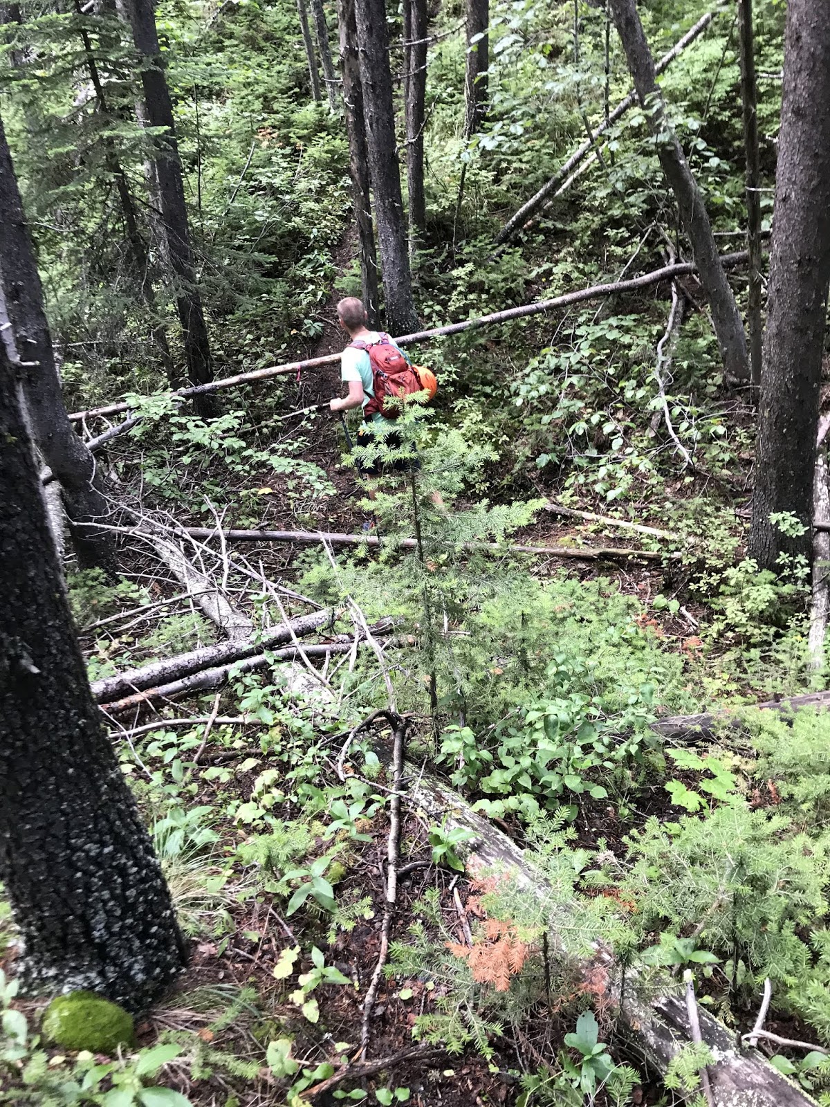
The trail along the boundary is up. It keeps going up. It heads right towards the mountains....up. We headed progressively up for what felt like an hour, but was probably 20 minutes. When you run out of park boundary, you will see a pile of pink/orange/white markings on the left. This is very obvious. If you go straight, you will experience what many climbers call Sudden Elevation Loss (or S.E.L for short), we called it Sudden Hill Inversion Trail (or S.H.I.T for short). Don't go down the death slope, follow the markings. If you can't figure that out, this mountain is not for you. There is a lovely campground trail that may be more fitting! lol.
Once you've found the trail markings, you will continue going up. This is the only portion of the trail marked well. This is a lovely vertical climb, that is unrelenting, and does not have much for switch backs. It's a grunt. The trail is very easy to follow all the way up to the bench. You'll know you are at the bench, because it is a fire break from a few years ago. From this point on, you are not going to see much for markings, or trail. It becomes a 'logic says I should go this way' kind of a thing.
 |
| Saddle selfie! |
At the saddle Tom and I left a wet shirt (it was hot, I sweat like a beast), and some flagging. We then continued to the right (it's the big hill headed in the direction of the summit). This is another grunt. As the trail fairies have not discovered this trail, there are no switch backs, or meanders. It's uphill. There are several of these micro summits in the fire break you will need to climb. The views behind you will be fantastic, and you will think you see the summit in front of you. It is not the summit. Not even close.
Once you climb the final micro summit in the fire break, you will be treated to your first of three S.H.I.Ts. This is demoralizing, as you lose a lot of your hard fought gain (why didn't they install a gondola, right?). The S.H.I.T leads down into a spooky forest, where we encountered a squadron of mosquitoes. Tom brought some bug spray, but it did nothing. The bugs were aggressive. Hurray for a wet summer. Once you bottom out in the spooky forest, you will have to route find over a lot of fallen trees. You will be heading straight mostly. Then you get to climb out of the spooky forest a gain back all those precious meters you lost. I saw a few pink ribbons on some of the blown down trees. It gave me hope.
 |
| First S.H.I.T |
 |
| Fabulously marked trail |
 |
| A few trees down |
 |
| The view after the climb out of the first S.H.I.T. |
From here you will appear to cliff out. Keep an eye to the left, as there is a route around the cliff, and a way to climb behind it. This gave me memories of Indiana Jones and the last Crusade, the part where he has to jump from the lion's head without seeing the path, not the part where the guy drinks from the cup and his face melts. This is the second S.H.I.T. You get to lose a bunch more vert,as you make your way to the next cliff. This is slow going. Don't get discouraged.
 |
| First view of the RedStreak |
 |
| Keep left to skirt the redstreak |
From here you will run into the 'redstreak' you've been seeing from time to time, you assume is the summit. The trail continues around this on the left as well (I keep using the word trail, but what I mean is 'occasionally disturbed dirt'). This is where to continue on, you must be confident in your scrambling abilities. You will approach what is know as the slab. Once you get close you will see a rope hanging down it. The fables tell me this has been there since about 2014, but history is hazy about this particular patch of dirt, but someone in the history of this mountain left their rope, without it, climbing would not be possible unless conditions were perfect.
 |
| Oh Look, a rope on a slab |
 |
| After the slab I went through the shale. Don't be like me. |
The slab was wet when we approached it, and the rope kept knocking lose rocks and small boulders. A helmet is highly recommended. I tested the rope several times to ensure it was still fixed properly, and would support my weight (160lbs). It did (obviously, I'm alive and writing this #captainobvious). There are several ways to conquer the slab. You can try and create your own switch backs (Tom's way), or go straight up it (my way). I did my version of 'Free Solo' going up, only to realize once you achieve the slab, you are in slippery shale, and the footing is absolute garbage.
Once you've gotten up the slab, pat yourself on the back, you'll feel like a proper mountaineer (rope climbing does that to a person!). Now comes the hard part. I know you're thinking, 'but Josh, the whole thing sounds like hell?', you are correct, but now you move onto another ring in Dante's inferno. Enjoy.
The next section is straight up steep. It's a choose your own adventure through the wash. It's long, and hard. It peeled the tread off one of my trail shoes. Don't worry, you can see the summit though. Summit fever will begin to set in here. You'll be going up the wash with reckless abandon. I'd recommend going up on the right side, where there are bushes and trees growing, the footing is marginally better, although the plants and bushes will scrap the ever living hell out of your legs and arms.
After you break out of the trees, it's a small hike to the summit. We were practically running at this point. We scrambled onto the ridge, looking for the glory that is the summit log. Nothing. Then it hit us. About a half km away, the true peak stood in front of us. To get to it we would have to scramble down the third S.H.I.T, and find a way up the rock face. This is a steep down. Take it slow. Once you approach the rock face, you will have an inclination to go left. It looks like the trail winds that way naturally. You will cliff out if you do this. Instead, head right, and carefully pick your way down the cliffs of doom. Once you've gotten to the bottom right of the rock face, you will see it is two separate rock faces, with a small wash between them. This is ticket up.
 |
| Go between the front face to hit the final scramble (bad picture, hard to see. It's there) |
Scramble up the second wash to the true summit.
We achieved the final summit, and found the log jar to make our mark(the next person to try it, please bring another sheet of paper!). The last person was from 2017. Before that, a pair from 2015. This is not a mountain for the faint of heart, or people that are afraid of exposure apparently. We sat at the top, and ate the Tim Horton's bagels we had packed for lunch, and drank some of the 4L of water we were carrying.
 |
| First page of Summit log |
 |
| Second page of summit log |
|
|
 |
| Views |
 |
| more views |
 |
| Even more views |
This is usually where the story ends. Cut scenes take you to the pub after, where the adventurers are having a beer, and regaling everyone with tales of their feats. This was not the case for us. Getting down was worse, far worse.
After a 15 minute break at the summit, we began the descent. It's basically a controlled fall down the wash to start. Be careful to stay in control, so you don't fall off the wash into oblivion, as you split the rocks to get down from the true summit. Remember those S.H.I.T's? Now you get to climb them. The climbing is not done at the top, this mountain is evil. After you get back to the false summit, you have to descend the wash back to the slab. STAY IN THE TREES! A controlled fall to the slab would be deadly, and by this point, a person's legs could be pretty tired.
 |
| Summit view down to the false summit |
 |
| Stay in the Trees on the way down |
Once on the slab, you have to repel down. Hopefully you've take a course, or watched a youtube tutorial. The mountain cell service, so I'd recommend watching a video on repelling at this point, and blowing your data overage. I anchored myself into the rope, and began the descent. Several feet in, the ledge I was on crumbled under me, send me falling until the slack was out of the rope, and my anchoring caught me. Rather scary moment. Once down, I changed my underwear, and let Tom get descend. He was going down in a switch back style, which triggered a mild rock slide, causing hundreds of rocks, big and small to crash onto his head. As he was wearing a helmet, this just rung his bell, and didn't kill him.
 |
| Tom Climbing down the slab |
Once you are off the slab, you will be backtracking into the woods. Its super easy to get lost, and finding the way you came can be difficult. We recorded our way up with Strava, so we could follow it down as well. We got of course several times on the way back to the second S.H.I.T, but each time course corrected with Strava. The second time around, the spooky forest, and first S.H.I.T will really suck. We were tired of climbing around/over dead fall, and the climb up the first S.H.I.T is vertical. I didn't appreciate how steep it was the first time. This part of the trail didn't get better the other direction.
 |
| Climbing up a S.H.I.T. |
This brings you back to the cut line. The views are amazing, but you have to stare at your feet, because the grade is awful. We ended up deciding to jog down the rest of the way. It's steep, and will hurt the knees to break step all the time. We picked up our gear drop in the saddle, and enjoyed the jog, controlled fall down to the beginning. You'll really appreciate how steep this trail actually is on the way down.
 |
| The View to the fire break |
The worst part, is the two km trail back to the campsite. You've done the impossible, you're in an elite group of people that have climbed Redstreak (or an incredibly stupid group), now misery walk for 20 minutes back to your vehicle. It was early afternoon when we invaded the campground again, people wondering why people coming off a golf course connector trail had enough gear to hike K2? No one will understand what you've done, or even that it's a thing to climb Redstreak, Most people assume its the hill behind the hot springs on the highway. So that is why I'm writing this guide, and posting the GPS, in hopes others will attempt and complete this, so one day we can all get together and brag to each other about things no one will ever understand, but are truly epic. Thanks for reading
Joshua Slykhuis
Aka The Canadian GhostRunner
Find me on:
Strava: Canadian Ghost Runner
Instagram: Canadianghostrunner
Twitter: @Canghostrunner
Or right here on facebook where I post random nonsense frequently.
 |
| The Summit selfie #TheWorldNeedsMoreSelfies |
 |
| Strava Data |


Comments
Post a Comment